Arc GIS 10.1

نسخه نهایی Arc GIS 10.1 در دو ماههای آتی ارائه خواهد شد این در نسخه آزمابشی این تغییرات عمده بوجود آمده است
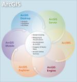
1- حذف Arc IMS که قدیمی ترین سرویس نقشه اینترنتی Arc GIS است اولین وب جی ای اس ها بر اساس این نرم افزار بوجود آمده اند . اگر هنوز هم میخواهید از این سرویس استفاده کنید میتوانید از نسخه های قبلی 10-9.3-9.3.1 در کنار نسخه 10.1 استفاده کنید
2-حذف Arc Info Workstation این نرم افزار هم سرنوشت مشابه Arc IMS دارد
3- به منظور استفاده بهینه از امکانات سخت افزاری و پشتیبانی از حافظه بالاتر و عملکرد بهتر پردازنده ها Arc GIS Server به صورت نسخه 64 بیتی طراحی شده است به این منظور PIAs آن به صورت 64 بیت طراحی شده در حالیکه دسکتاپ بدون تغییرباقی مانده است
4- نسخه های فعلی Arc GIS Server تحت دو عنوان ArcGIS Server for the Microsoft .NET
Framework, and ArcGIS Server for the Java Platform هستند اما در نسخه جدید نام آنها بصورت زیر تغییر خواهد کرد
- ArcGIS for Server (Windows
- ArcGIS for Server (Linux)
۵- سازگاری کامل با پلتفورم های ۶۴ بیتی
6- Web ADF Control در این نسخه برای برنامه نویسان وب وجود دارد اما برنامه نویسان Web GIS بر پایه محصولات ESRI باید توجه داشته باشید خط و مشی این شرکت در زمینه Web GIS استفاده از Web Mapping API است و بنا به نظر شخصی من Arc GIS Web Application Developper FrameWork نیز در نسخه 10.2 حذف خواهد شد(نظر شخصی)
۷- توسعه برنامه توسط آرک آبجکت در محیط دات نت فقط با ویژوال استودیو ۲۰۱۰ امکان پذیر است . نسخه های قدیمیتر پشتیبانی نمیشود (نسخه ۲۰۰۸)
8- عدم پشتیبانی از Arc Reader , Arc GIS Engine در سیستم عامل سولاریس
9- نسخه 10.1 Arc GIS Server از ژئودیتابیس شخصی(Personal Geodatabase ) شامل فایل ژئودیتابیس و اکسس ژئودیتابیس پشتیبانی نمیکند اما کماکان میتوانید از این نوع ژئودیتابیس در Arc GIS Desktop استفاده کنید
10 - تغییر نام برنامه ها مطابق زیر
- Arc GIS Desktop--> Arc GIS For Desktop
- Arc Info --> Arc GIS For Desktop Advanced
- Arc Editor --> Arc GIS For Desktop Standard
- Arc View --> Arc GIS For Desktop Basic
- Arc GIS Server --> Arc GIS For Server
- Arc GIS Runtime --> Arc GIS Engine
- Arc GIS Server Image --> Arc GIS Image Extension For Server
- Spatial Analyst--> Arc GIS Spatial Analyst For Desktop/Server /Engine /Runtime -
11- ایجاد دو رانتایم جدید برای ارائه آسان برنامه برای جاوا و WPF
 این وبلاگ با هدف معرفی و گسترش